New York mayor reveals plan to extend Manhattan shoreline in response to climate change
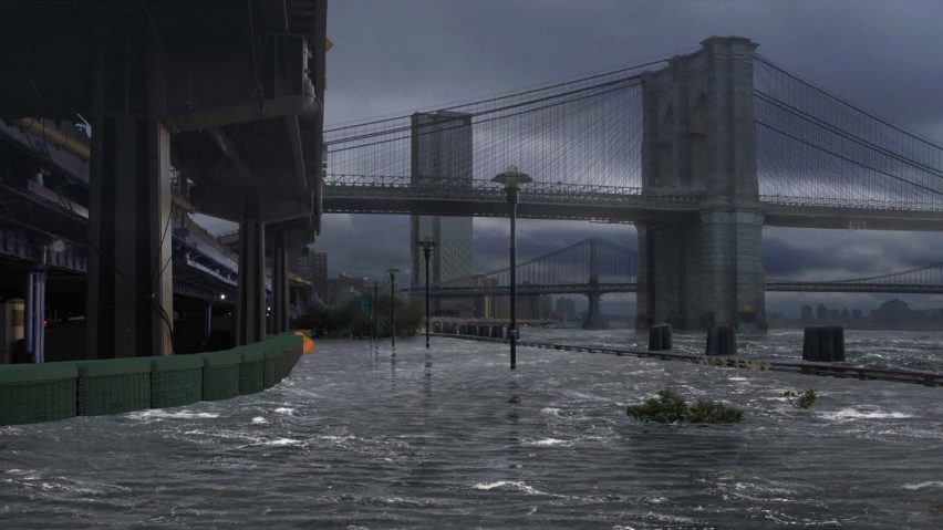
New York City mayor Bill de Blasio has revealed a proposal to redesign the "vulnerable" shoreline of Lower Manhattan, in order to make it more resilient to rising sea levels caused by climate change.
Released by the New York City Economic Development Corporation (NYCEDC), on 15 March 2019, the Lower Manhattan Climate Resilience (LMCR) outlines a series of longterm and temporary measures to bolster the city's urban coastal area.
The multi-billion dollar coastal resilience proposal would extend the Lower Manhattan shoreline into the East River.
Extended Lower Manhattan shoreline to act as flood barrier
Called the Financial District and Seaport Climate Resilience Master Plan, the new shoreline would act as a flood barrier during storms and protect the neighbourhoods against a projected rise in sea level.
The plan is "the only feasible way to protect these vulnerable and vital parts of the city", said New York City's mayor Bill de Blasio in a statement released by NYCEDC.
"To close the gap and protect this area, the City will complete the Financial District and Seaport Climate Resilience Master Plan over the next two years to develop a comprehensive design for a shoreline extension in this area and to establish a public benefit corporation that will finance, construct, and manage it," the report said.
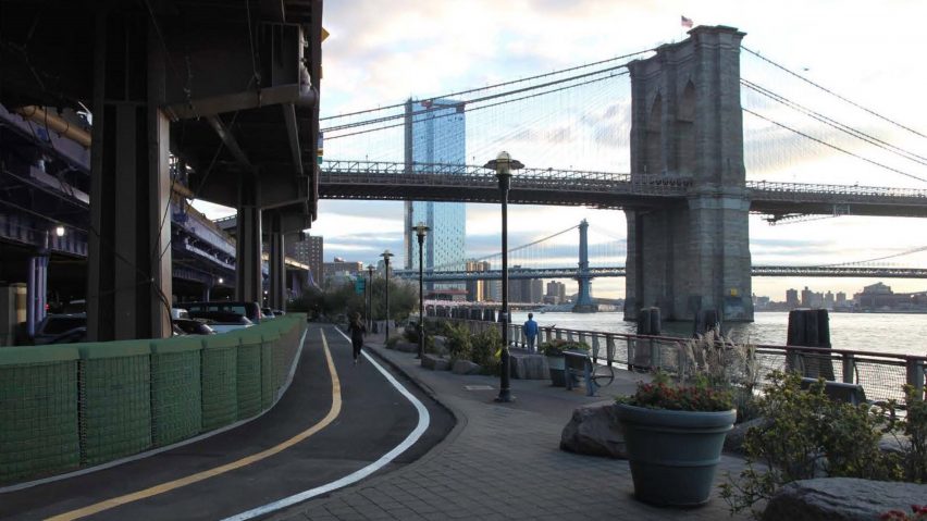
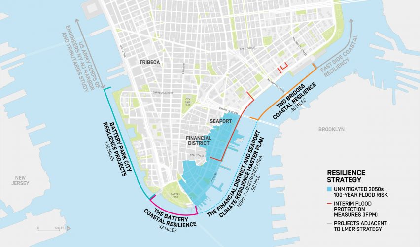
Lower Manhattan is a peninsula that comprises a range of neighbourhoods – including the Financial District, South Street Seaport, Battery Park and Two Bridges.
The area-at-large interacts with three different waterways: the East River, the Hudson River, and New York bay, which is an extension of the Atlantic Ocean, making it particularly susceptible to rising sea levels.
Lower Manhattan at high risk of flooding in next 30 years
Visuals from the research show the impending rise in water along these areas, projecting that by the 2050s, 37 per cent of Lower Manhattan will be at risk from storm surge. Almost 50 per cent of properties will be at risk from the surge as well.
By the year 2100, sea level is projected to have risen six feet (1.8 metres) in the area, with 20 per cent of streets of Lower Manhattan exposed to tidal inundation.
In response to this, the masterplan proposes extending areas by 500 feet (152 metres) – equivalent to two city blocks. These will be either at or above sea level, although details are yet to be confirmed.
"The exact extent of the new shoreline, along with the design and construction of this innovative flood protection system, will be determined through an extensive public engagement process," said NYCEDC.
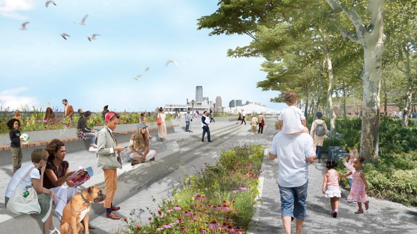
Other plans include grassy berms in parks and removable barriers, which can be anchored in the face of looming storms.
While the resiliency approach to extend the island may appear drastic, the team came up with the solution due to the area's tricky circumstances.
Lower Manhattan's areas are low-lying and have an active waterfront already. They also suffer from a lack of available space to build dense infrastructure, either above and below ground. The FDR expressway, Battery Tunnel and the A/C/E subway lines constrain the region.
"Taken together, these elements mean that more traditional on-land flood protection measures are not feasible," continued NYCEDC.
Other environmental problems expected to be triggered by climate change are tidal inundation, storm surge, extreme rain, and heat waves.
Rising sea levels will also cause groundwater-related problems in the metropolis. It is projected that the groundwater table will rise and put seven per cent of buildings at risk of destabilisation. Streets with underground utilities will be exposed to corrosion.
Masterplan forms part of wider initiative to bolster New York waterfront
In total, the wider Lower Manhattan Climate Resilience plan projects to protect up to 70 per cent of the area, based on a scheme that will cost $500 million (£379 million).
Four private projects are either already underway or planned to start in the city. The city will advance funds for these capital projects.
Among these is a proposal for South Street Seaport, the Financial District and Two Bridges, where Emergency Management (EM) will deploy a combination of rapid deployment barriers called Tiger Dams and bastions by HESCO.
This plan is to bolster in time for the 2019 hurricane season – running from 1 June to 30 November 2019. It is a temporary measure, in advance of a permanent solution, and will cost $3.5 million (£2.65 million).
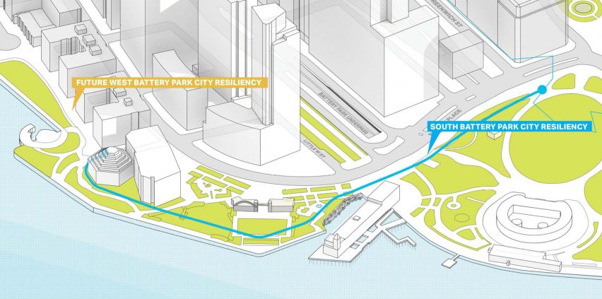
The second capital project is for Battery Park City and includes the reconstruction of the park's esplanade and more open space to adapt to new climate conditions. Construction is to start in 2020 by the Battery Park City Authority (BPCA), with an estimated cost $134 million (£101 million).
Another scheme, also for the Battery area, will elevate the local wharf and esplanade, and integrate a protective barrier, such as a berm at the back of the park to strengthen the shoreline.
Construction for this is expected to begin in 2021 and estimated to cost $165 million. The plan is managed by NYCEDC in partnership with NYC Parks, BPCA and the Battery Conservancy.
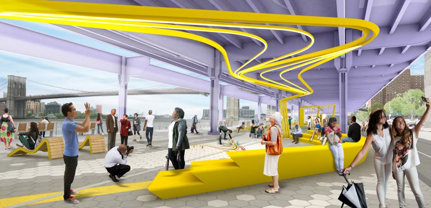
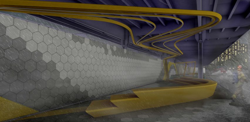
The fourth and final scheme is for Two Bridges – a triangular waterfront area of on the East River in Lower Manhattan, enclosed by the Brooklyn and Manhattan bridges.
It comprises an integrated flood protection system of permanent barriers and deployable protection. The city's Department of Design and Construction (DD) will manage construction, planned to start in 2021.
The initiative is part of a $200 million investment, led by NYCEDC.
The master plan for the LMCR study is scheduled to be completed in 2021, following which a first phase for the project will be developed. The next step for NYCEDC is to file a Request for Qualification (RFQ) to create a team of engineers and designers for projects.
The LCMR report as funded by both New York City and state, through federal disaster appropriations after Hurricane Sandy in fall 2012.
"Hurricane Sandy hit New York City, flooding 17 per cent of the city's land, claiming 44 lives, and causing $19 billion (£14.3 billion) in damages and lost economic activity," said the study.
Along with these city and federal initiatives, local teams are also working on climate change solutions for the city. Brooklyn-based architecture firm BIG has proposed a barrier system for Lower Manhattan as well.
US cities develop resiliency plans in response to climate change
New York's response to climate change follows a number of drastic and unpredictable weather events in the US, including hurricanes that devastated cities in Florida and Texas, which called for changes in urban planning.
"We need the federal government to stand behind cities like New York to meet this crisis head-on," said de Blasio.
Other cities in America have similarly launched investigations to bolster their coastlines. Boston and Miami are taking steps to address flooding, while San Francisco and the Bay Area unveiled a design competition asking for ways to protect coastal areas from rising sea levels, as well as earthquakes.
Images are courtesy of NYCEDC.
Project credits:
Primary project consultants: AECOM, HR&A Advisors, Bjarke Ingels Group, One Architecture, James Lima Planning + Development
Public offices and agencies: Mayor’s Office of Recovery and Resiliency (ORR), NYC Economic Development Corporation (EDC), Governor's Office of Storm Recovery