PBWC Architects uses 3D lidar scan to win permission for Cornwall house
Cornish firm PBWC Architects has utilised 3D laser-scanning technology to create an accurate model of the rocky site and listed surroundings of a house for St Ives, which has just received planning permission (+ slideshow).
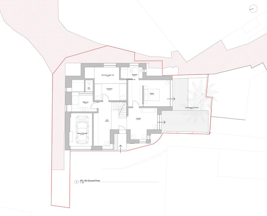
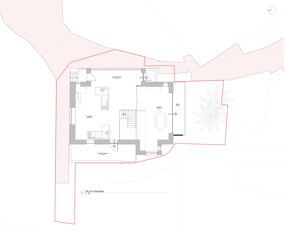
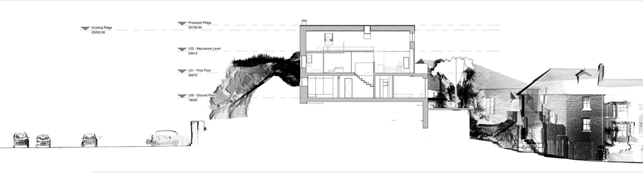
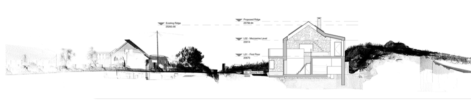
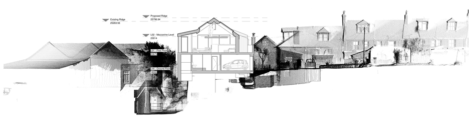
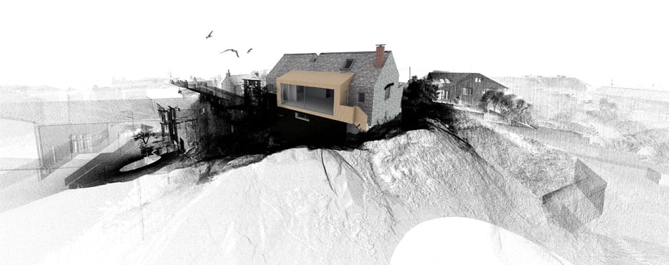
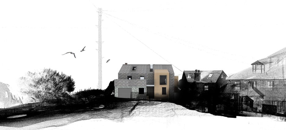
The local studio used the technology when designing the Rock House, a two-and-a-half storey replacement dwelling for a site on Carncrows Rock within the St Ives Conservation Area.
To obtain a digital model of the existing building and complex site, which includes a granite outcrop and adjacent Grade-II listed properties, PBWC architect Jacob Down asked CESurveys to take a lidar scan of the area.
"More conventional surveying techniques would have proved problematic with limited use and accuracy," said Down.
"The high level of contextual information helped foresee many planning-related issues resulting in smooth and successful planning outcome," added Down.
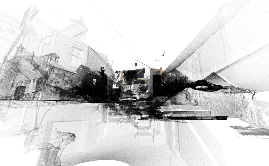
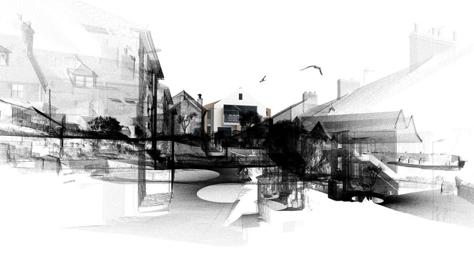
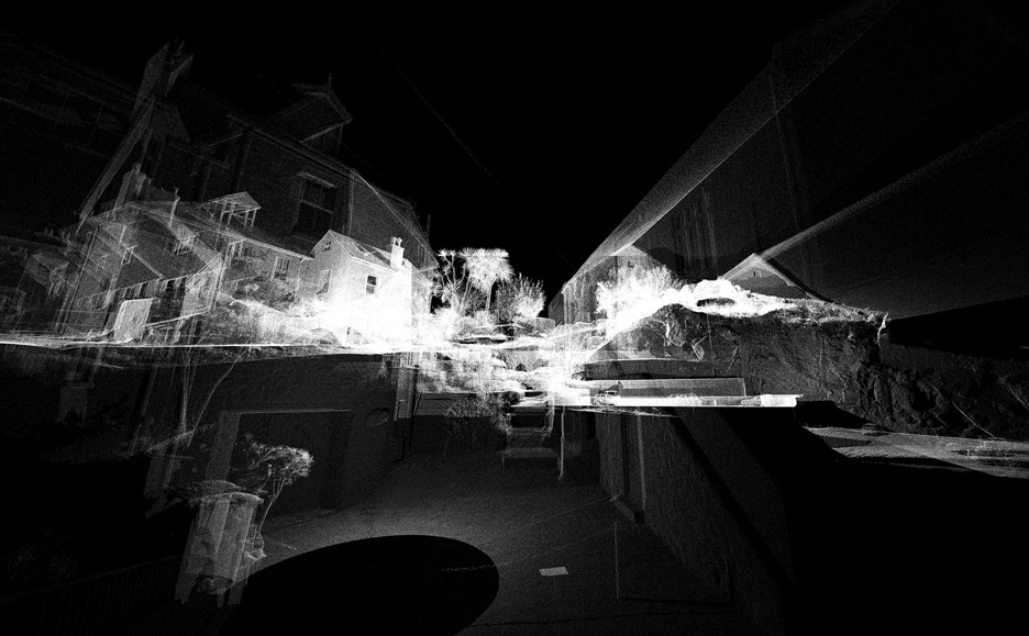
The lidar scanner fires tens of thousands of laser beams per second in almost all directions and records a point each time a beam hits a surface.
Multiple scans are usually taken from different viewpoints and stitched together, forming a 3D map made up of coordinate points with accuracies of up to 0.01 millimetres.
The map of the site, known as a pointcloud, was then combined with building information modelling (BIM) software to be used throughout the design process.
"This provided an unprecedented amount of information of the site and existing building eliminating the need for many additional site visits," said Down.
The architects believe that Rock House was originally a boat cellar and net maker's loft. The proposal retains the historic north gable of the building and replaces the rest of the structure with a contemporary interpretation.
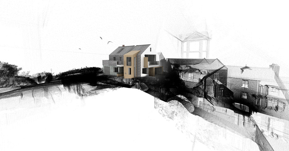
PBWC used the scan to help maintain existing sea views from the property, as well as plan new ones from a mezzanine viewing platform.
Construction of Rock House is due to start in Autumn 2016. PBWC Architects is also utilising 3D lidar scanning technology on many of its other projects.
"The technology has actually been around for a while, used by crime scene and road traffic investigators to capture the aftermath of incidents with high degrees of accuracy," Down told Dezeen. "Scenes and roads could be reopened without causing unnecessary disruption to the public, whilst further detailed investigations could be undertaken by utilising the 3D-scanned data."
3D scanning has come on leaps and bounds over the past few years, with projects demonstrating its potential benefits for everything from fashion to urban design.
William Trossell, co-founder of ScanLAB, previously told Dezeen that the advancement and proliferation of 3D-scanning technology means we will soon be able to explore a life-size digital replica of the real world.